
Sandy Bend topographic map
Interactive map
Click on the map to display elevation.
About this map
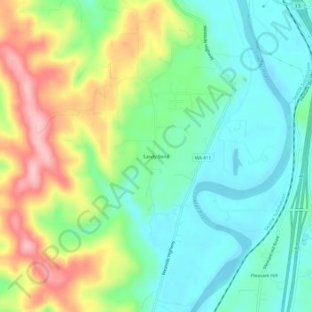
Name: Sandy Bend topographic map, elevation, terrain.
Location: Sandy Bend, Cowlitz County, Washington, USA (46.22067 -122.93400 46.26067 -122.89400)
Average elevation: 61 m
Minimum elevation: -3 m
Maximum elevation: 176 m