
เกาะรัง topographic map
Interactive map
Click on the map to display elevation.
About this map
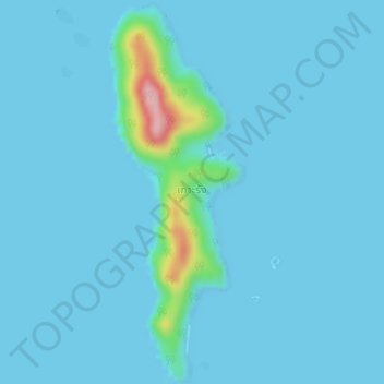
Name: เกาะรัง topographic map, elevation, terrain.
Location: เกาะรัง, จังหวัดตราด, Thaïlande (11.77721 102.38055 11.81164 102.39322)
Average elevation: 11 m
Minimum elevation: 0 m
Maximum elevation: 168 m
Other topographic maps
Click on a map to view its topography, its elevation and its terrain.
หาดคลองเจ้า
Thaïlande > จังหวัดตราด > หาดคลองเจ้า
หาดคลองเจ้า, จังหวัดตราด, 23120, Thaïlande
Average elevation: 41 m