
Rayachoti topographic map
Interactive map
Click on the map to display elevation.
About this map
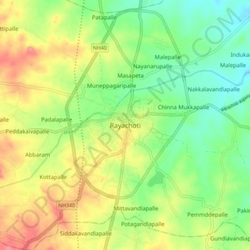
Name: Rayachoti topographic map, elevation, terrain.
Location: Rayachoti, YSR, Andhra Pradesh, 516269, India (14.01552 78.71102 14.09552 78.79102)
Average elevation: 358 m
Minimum elevation: 323 m
Maximum elevation: 404 m