
Tangkuban Perahu topographic map
Interactive map
Click on the map to display elevation.
About this map
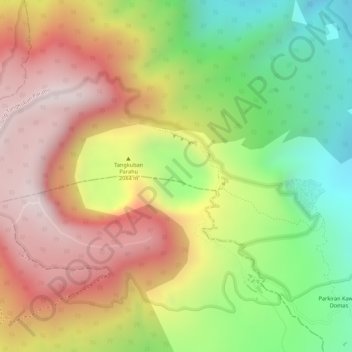
Name: Tangkuban Perahu topographic map, elevation, terrain.
Location: Tangkuban Perahu, Cimahi, West-Java, 41281, Indonesien (-6.75921 107.61533 -6.75911 107.61543)
Average elevation: 1,800 m
Minimum elevation: 1,487 m
Maximum elevation: 2,069 m