
Zutphen topographic map
Interactive map
Click on the map to display elevation.
About this map
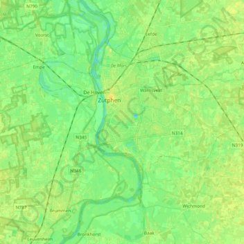
Name: Zutphen topographic map, elevation, terrain.
Location: Zutphen, Gelderland, Nederland (52.08873 6.14039 52.16980 6.32831)
Average elevation: 9 m
Minimum elevation: -1 m
Maximum elevation: 17 m
Topografisch kaartbeeld van de gemeente Zutphen, per maart 2017. Klik op de kaart voor een vergroting.