
Lepelstraat topographic map
Interactive map
Click on the map to display elevation.
About this map
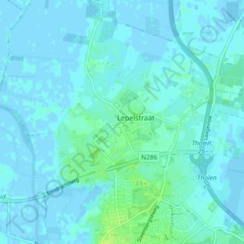
Name: Lepelstraat topographic map, elevation, terrain.
Location: Lepelstraat, Noord-Brabant, Nederland, 4664, Nederland (51.52823 4.25292 51.56823 4.29292)
Average elevation: 2 m
Minimum elevation: -3 m
Maximum elevation: 11 m