
Ichalkaranji topographic map
Interactive map
Click on the map to display elevation.
About this map
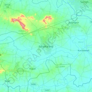
Name: Ichalkaranji topographic map, elevation, terrain.
Average elevation: 562 m
Minimum elevation: 526 m
Maximum elevation: 842 m
Ichalkaranji is located at 16°42′N 74°28′E / 16.7°N 74.47°E / 16.7; 74.47. It has an average elevation of 538 metres (1768 ft).
Other topographic maps
Click on a map to view its topography, its elevation and its terrain.
Hupari
India > Maharashtra > Hatkanangle
Hupari, Hatkanangle, Kolhapur District, Maharashtra, 416203, India
Average elevation: 557 m