
Rajamahendravaram topographic map
Interactive map
Click on the map to display elevation.
Rajamahendravaram
Rajahmundry is located at 16°59′N 81°47′E / 16.98°N 81.78°E / 16.98; 81.78. with an average elevation of 14 metres (46 ft). It is geographically located at centre of Godavari Districts.There is paddy, sugarcane and various varieties of flowers cultivation in the area. River Godavari flows through the west of Rajahmundry.
About this map
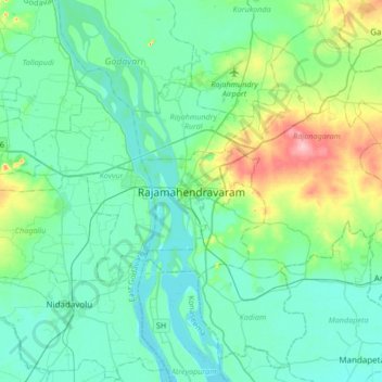
Name: Rajamahendravaram topographic map, elevation, terrain.
Average elevation: 29 m
Minimum elevation: 4 m
Maximum elevation: 130 m