
Phaltan topographic map
Interactive map
Click on the map to display elevation.
About this map
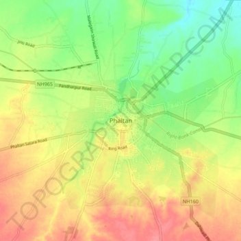
Name: Phaltan topographic map, elevation, terrain.
Location: Phaltan, Satara, Maharashtra, 415523, India (17.95077 74.38988 18.03077 74.46988)
Average elevation: 561 m
Minimum elevation: 526 m
Maximum elevation: 594 m
Other topographic maps
Click on a map to view its topography, its elevation and its terrain.
Adarki
India > Maharashtra > Phaltan
Adarki, Phaltan, Satara, Maharashtra, India
Average elevation: 694 m
Sakharwadi
India > Maharashtra > Phaltan > Sakharwadi
Sakharwadi, Phaltan, Satara, Maharashtra, 415528, India
Average elevation: 551 m