
Mandvi topographic map
Interactive map
Click on the map to display elevation.
About this map
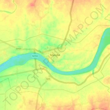
Name: Mandvi topographic map, elevation, terrain.
Location: Mandvi, Mandvi Taluka, Surat, Gujarat, 394160, India (21.21493 73.26464 21.29493 73.34464)
Average elevation: 47 m
Minimum elevation: 21 m
Maximum elevation: 64 m