
Paithan topographic map
Interactive map
Click on the map to display elevation.
About this map
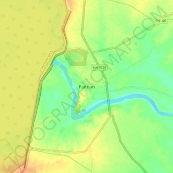
Name: Paithan topographic map, elevation, terrain.
Location: Paithan, Aurangabad, Maharashtra, 431107, India (19.43336 75.34681 19.51336 75.42681)
Average elevation: 452 m
Minimum elevation: 429 m
Maximum elevation: 476 m
Paithan is located at 19°29′N 75°23′E / 19.48°N 75.38°E / 19.48; 75.38. It has an average elevation of 458 m (1,503 ft).