
Bruges topographic map
Interactive map
Click on the map to display elevation.
About this map
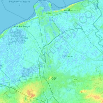
Name: Bruges topographic map, elevation, terrain.
Location: Bruges, Brugge, West Flanders, Flanders, Belgium (51.15822 3.13418 51.36335 3.30980)
Average elevation: 3 m
Minimum elevation: -3 m
Maximum elevation: 26 m