
Zijtaart topographic map
Interactive map
Click on the map to display elevation.
About this map
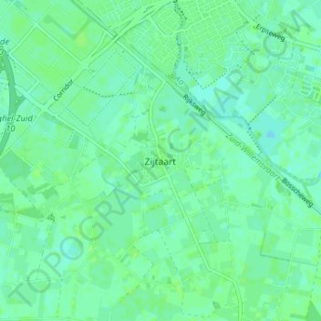
Name: Zijtaart topographic map, elevation, terrain.
Average elevation: 11 m
Minimum elevation: 7 m
Maximum elevation: 14 m
Other topographic maps
Click on a map to view its topography, its elevation and its terrain.
Veghel
Nederland > Noord-Brabant > Veghel
Veghel, Noord-Brabant, Nederland, 5461KN, Nederland
Average elevation: 11 m
Havelt
Nederland > Noord-Brabant > Veghel > Zijtaart
Havelt, Zijtaart, Veghel, Meierijstad, Noord-Brabant, Nederland, 5463 PC, Nederland
Average elevation: 11 m
Eerde
Nederland > Noord-Brabant > Veghel
Eerde, Veghel, Meierijstad, Noord-Brabant, Nederland, 5466 PE, Nederland
Average elevation: 11 m
Driehuizen
Nederland > Noord-Brabant > Veghel > Mariaheide
Driehuizen, Mariaheide, Veghel, Meierijstad, Noord-Brabant, Nederland, 5464 RA, Nederland
Average elevation: 10 m