
Gadag-Betageri topographic map
Interactive map
Click on the map to display elevation.
About this map
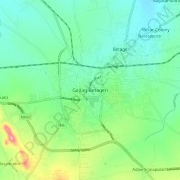
Name: Gadag-Betageri topographic map, elevation, terrain.
Average elevation: 664 m
Minimum elevation: 623 m
Maximum elevation: 773 m
Other topographic maps
Click on a map to view its topography, its elevation and its terrain.
Hulakoti
India > Karnataka > Gadag taluk > Hulakoti
Hulakoti, Gadag taluk, Gadag district, Karnataka, India
Average elevation: 654 m