
Dhule topographic map
Interactive map
Click on the map to display elevation.
About this map
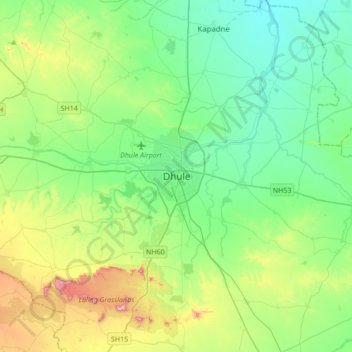
Name: Dhule topographic map, elevation, terrain.
Location: Dhule, Maharashtra, 424001, India (20.73800 74.61320 21.05800 74.93320)
Average elevation: 312 m
Minimum elevation: 195 m
Maximum elevation: 649 m