
Setagaya topographic map
Interactive map
Click on the map to display elevation.
About this map
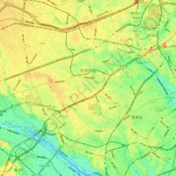
Name: Setagaya topographic map, elevation, terrain.
Location: Setagaya, Tokyo, Japan (35.58998 139.58249 35.68282 139.68639)
Average elevation: 35 m
Minimum elevation: -2 m
Maximum elevation: 73 m
Other topographic maps
Click on a map to view its topography, its elevation and its terrain.