
Balaghat topographic map
Interactive map
Click on the map to display elevation.
About this map
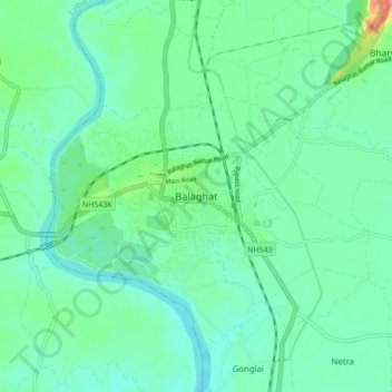
Name: Balaghat topographic map, elevation, terrain.
Average elevation: 304 m
Minimum elevation: 281 m
Maximum elevation: 384 m
Balaghat is located at 21°48′N 80°11′E / 21.800°N 80.183°E / 21.800; 80.183. It has an average elevation of 288 metres (944 feet).
Other topographic maps
Click on a map to view its topography, its elevation and its terrain.
Lamta
India > Madhya Pradesh > Balagat Tahsil
Lamta, Balagat Tahsil, Balaghat District, Madhya Pradesh, 481551, India
Average elevation: 359 m