
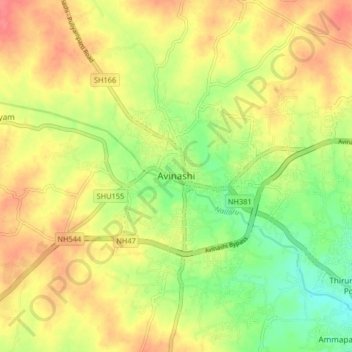
Avinashi topographic map
Interactive map
Click on the map to display elevation.
About this map
Name: Avinashi topographic map, elevation, terrain.
Average elevation: 334 m
Minimum elevation: 301 m
Maximum elevation: 361 m
Avinashi has an average elevation of 313 metres (1030 feet).
Other topographic maps
Click on a map to view its topography, its elevation and its terrain.
GANDHI NAGAR
India > Tamil Nadu > Avanashi
GANDHI NAGAR, Avanashi, Tiruppur District, Tamil Nadu, India
Average elevation: 347 m