
തൃശൂര് topographic map
Interactive map
Click on the map to display elevation.
About this map
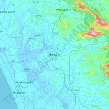
Name: തൃശൂര് topographic map, elevation, terrain.
Location: തൃശൂര്, Thrissur, Kerala, 680001, India (10.36560 76.05338 10.68560 76.37338)
Average elevation: 36 m
Minimum elevation: -8 m
Maximum elevation: 516 m