
Achali topographic map
Interactive map
Click on the map to display elevation.
About this map
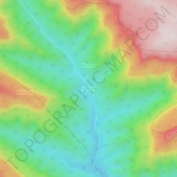
Name: Achali topographic map, elevation, terrain.
Location: Achali, Jaoli, Satara, Maharashtra, India (17.84762 73.68159 17.88762 73.72159)
Average elevation: 928 m
Minimum elevation: 684 m
Maximum elevation: 1,313 m