
Frimley topographic map
Interactive map
Click on the map to display elevation.
About this map
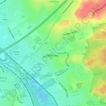
Name: Frimley topographic map, elevation, terrain.
Location: Frimley, Surrey, South East, England, United Kingdom (51.30995 -0.75831 51.32217 -0.72095)
Average elevation: 78 m
Minimum elevation: 56 m
Maximum elevation: 115 m