
Yenimahalle topographic map
Interactive map
Click on the map to display elevation.
About this map
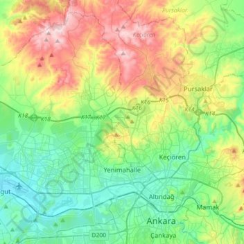
Name: Yenimahalle topographic map, elevation, terrain.
Location: Yenimahalle, Ankara, Central Anatolia Region, Turkey (39.91100 32.56433 40.10616 32.84706)
Average elevation: 1,000 m
Minimum elevation: 793 m
Maximum elevation: 1,489 m
Other topographic maps
Click on a map to view its topography, its elevation and its terrain.