
Kandwal topographic map
Interactive map
Click on the map to display elevation.
About this map
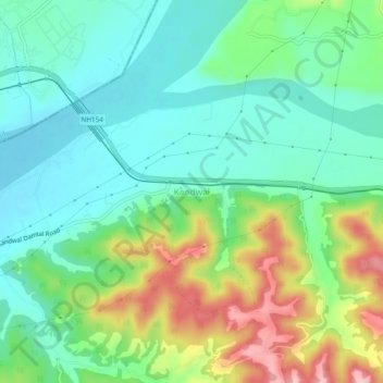
Name: Kandwal topographic map, elevation, terrain.
Location: Kandwal, Nurpur, Kangra, Himachal Pradesh, India (32.25892 75.75977 32.29892 75.79977)
Average elevation: 430 m
Minimum elevation: 380 m
Maximum elevation: 535 m