
Golaghat topographic map
Interactive map
Click on the map to display elevation.
About this map
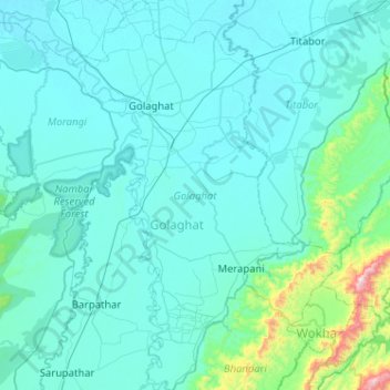
Name: Golaghat topographic map, elevation, terrain.
Location: Golaghat, Assam, India (26.17458 93.87096 26.63430 94.17736)
Average elevation: 168 m
Minimum elevation: 82 m
Maximum elevation: 1,212 m
Other topographic maps
Click on a map to view its topography, its elevation and its terrain.