
Kalol topographic map
Interactive map
Click on the map to display elevation.
Kalol
Kalol has an average elevation of 81 metres (266 feet). SH41 Highway passes through Kalol. The city sits on the banks of the Sabarmati River, in North-Central-East Gujarat.
About this map
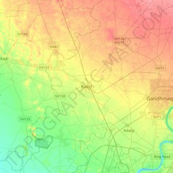
Name: Kalol topographic map, elevation, terrain.
Location: Kalol, Kalol Taluka, Gandhinagar, Gujarat, 382700, India (23.08522 72.33662 23.40522 72.65662)
Average elevation: 70 m
Minimum elevation: 41 m
Maximum elevation: 103 m