
Vaghai Taluka topographic map
Interactive map
Click on the map to display elevation.
About this map
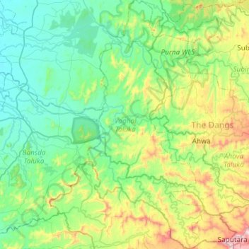
Name: Vaghai Taluka topographic map, elevation, terrain.
Location: Vaghai Taluka, The Dangs, Gujarat, India (20.56260 73.46563 21.01489 73.69397)
Average elevation: 275 m
Minimum elevation: 56 m
Maximum elevation: 1,041 m