
Madayi topographic map
Interactive map
Click on the map to display elevation.
About this map
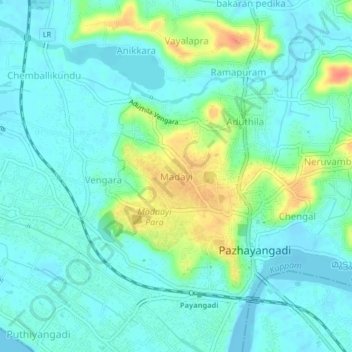
Name: Madayi topographic map, elevation, terrain.
Location: Madayi, Kannur, Kannur district, Kerala, India (12.01520 75.23755 12.05520 75.27755)
Average elevation: 13 m
Minimum elevation: -2 m
Maximum elevation: 51 m