
Elanji topographic map
Interactive map
Click on the map to display elevation.
About this map
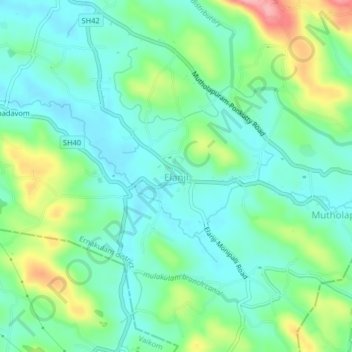
Name: Elanji topographic map, elevation, terrain.
Location: Elanji, Muvattupuzha, Ernakulam District, Kerala, 686665, India (9.81115 76.52438 9.85115 76.56438)
Average elevation: 41 m
Minimum elevation: 5 m
Maximum elevation: 131 m
Other topographic maps
Click on a map to view its topography, its elevation and its terrain.