
Dewas topographic map
Interactive map
Click on the map to display elevation.
About this map
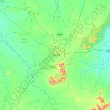
Name: Dewas topographic map, elevation, terrain.
Location: Dewas, Dewas Tahsil, Dewas, Madhya Pradesh, 455001, India (22.80363 75.89487 23.12363 76.21487)
Average elevation: 528 m
Minimum elevation: 480 m
Maximum elevation: 707 m
Other topographic maps
Click on a map to view its topography, its elevation and its terrain.
Kali Sindh
India > Madhya Pradesh > Dewas
Kali Sindh, Dewas, Madhya Pradesh, 455001, India
Average elevation: 539 m