
Lignerolles topographic map
Interactive map
Click on the map to display elevation.
About this map
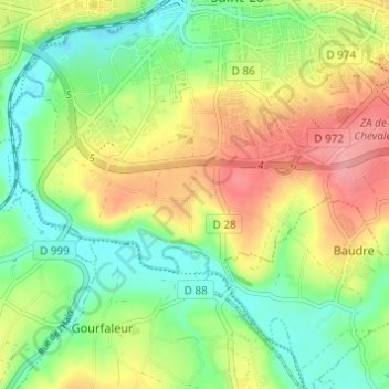
Name: Lignerolles topographic map, elevation, terrain.
Average elevation: 50 m
Minimum elevation: 8 m
Maximum elevation: 106 m
Other topographic maps
Click on a map to view its topography, its elevation and its terrain.
Le Haut Candol
France > Normandie > Manche > Saint-Lô
Le Haut Candol, Saint-Lô, Manche, Normandie, France métropolitaine, 50000, France
Average elevation: 48 m
Le Clos Vignot
France > Normandie > Manche > Saint-Lô > Le Clos Vignot
Le Clos Vignot, Saint-Lô, Manche, Normandie, France métropolitaine, 50000, France
Average elevation: 89 m