
Chandipur topographic map
Interactive map
Click on the map to display elevation.
About this map
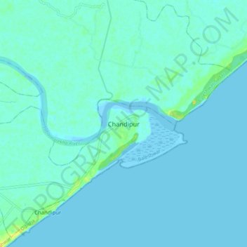
Name: Chandipur topographic map, elevation, terrain.
Average elevation: 3 m
Minimum elevation: -2 m
Maximum elevation: 21 m
Chandipur is located at 21°28′N 87°01′E / 21.47°N 87.02°E / 21.47; 87.02. It has an average elevation of 3 m (9.8 ft). This town is 51.330 acres (0.20773 km2) in size. Chandipur beach can be submerged at high tide.