
Delthota topographic map
Interactive map
Click on the map to display elevation.
About this map
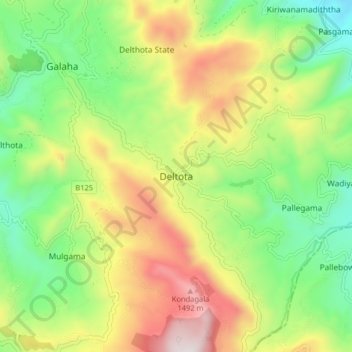
Name: Delthota topographic map, elevation, terrain.
Location: Delthota, Kandy District, Central Province, Sri Lanka (7.13266 80.65600 7.21266 80.73600)
Average elevation: 975 m
Minimum elevation: 528 m
Maximum elevation: 1,627 m