
Dena topographic map
Interactive map
Click on the map to display elevation.
About this map
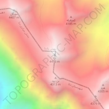
Name: Dena topographic map, elevation, terrain.
Average elevation: 3,896 m
Minimum elevation: 2,746 m
Maximum elevation: 4,415 m
Mount Dena has more than 40 peaks higher than 4,000 metres (13,000 feet). With an elevation of 4,409 metres above sea level, Qash-Mastan is the highest peak in the Dena Range and in the Zagros Mountains in general. Another known peak in this range is Hose-Daal close to the city of Sisakht, 30 km (19 mi) to the north of Yasuj.