
Lewis County topographic map
Interactive map
Click on the map to display elevation.
About this map
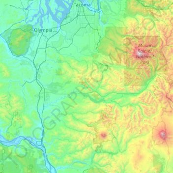
Name: Lewis County topographic map, elevation, terrain.
Location: Lewis County, Washington, United States (46.38127 -123.37090 46.79445 -121.35268)
Average elevation: 558 m
Minimum elevation: -3 m
Maximum elevation: 4,320 m