
Lushoto topographic map
Interactive map
Click on the map to display elevation.
About this map
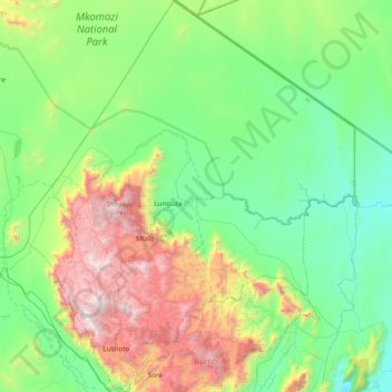
Name: Lushoto topographic map, elevation, terrain.
Location: Lushoto, Tanga, Northern Zone, Tanzania (-4.92796 38.15663 -4.15765 38.82991)
Average elevation: 722 m
Minimum elevation: 154 m
Maximum elevation: 2,293 m