Geolocate

Sohna topographic map

Interactive map

Click on the map to display elevation.

About this map

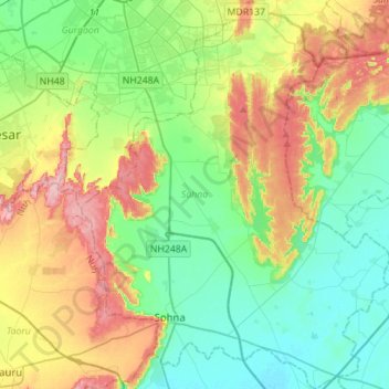
Name: Sohna topographic map, elevation, terrain.

Location: Sohna, Gurugram, Haryana, 122102, India (28.20057 77.00314 28.44658 77.24187)

Average elevation: 242 m

Minimum elevation: 191 m

Maximum elevation: 342 m

Other topographic maps

Click on a map to view its topography, its elevation and its terrain.

Sohna

India > Haryana > Gurugram

Average elevation: 229 m

Najafgarh Jheel

India > Haryana > Gurugram > Daultalbad Village

Average elevation: 211 m

Abhyapur

India > Haryana > Gurugram > Abhyapur

Average elevation: 219 m

Damdama

India > Haryana > Gurugram > Damdama

Average elevation: 233 m

Dhulkot

India > Haryana > Gurugram > Dhulkot

Average elevation: 214 m

Sector 108

India > Haryana > Gurugram > Dharampur

Average elevation: 212 m