
Saligao topographic map
Interactive map
Click on the map to display elevation.
About this map
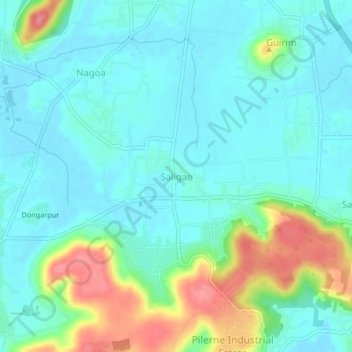
Name: Saligao topographic map, elevation, terrain.
Location: Saligao, Bardez, North Goa District, Goa, 403510, India (15.52857 73.76947 15.56857 73.80947)
Average elevation: 22 m
Minimum elevation: 1 m
Maximum elevation: 84 m
Other topographic maps
Click on a map to view its topography, its elevation and its terrain.