
Åland Islands topographic map
Interactive map
Click on the map to display elevation.
About this map
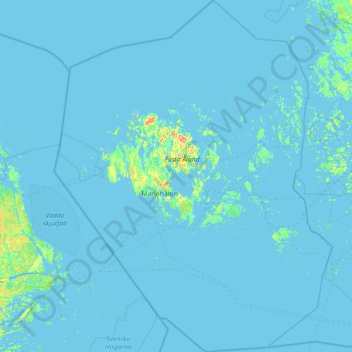
Name: Åland Islands topographic map, elevation, terrain.
Average elevation: 2 m
Minimum elevation: -4 m
Maximum elevation: 118 m
Other topographic maps
Click on a map to view its topography, its elevation and its terrain.
Fasta Åland
Finland > Åland Islands > Sund
Fasta Åland, Sund, Ålands landsbygd, Åland Islands, Regional State Agency Åland, Åland Islands, Finland
Average elevation: 9 m