
Riau Islands topographic map
Interactive map
Click on the map to display elevation.
About this map
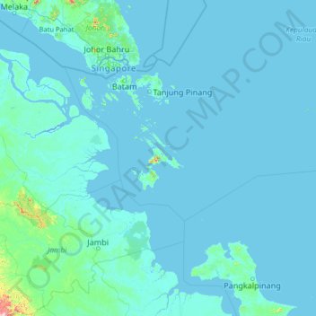
Name: Riau Islands topographic map, elevation, terrain.
Location: Riau Islands, Indonesia (-2.71478 102.02037 2.40522 107.14037)
Average elevation: 17 m
Minimum elevation: -3 m
Maximum elevation: 1,683 m
Other topographic maps
Click on a map to view its topography, its elevation and its terrain.
Citra Indah
Indonesia > Riau Islands > Batam City > Teluk Tering
Citra Indah, Teluk Tering, Batam City, Riau Islands, 29456, Indonesia
Average elevation: 18 m
Pangkalan Petai
Indonesia > Riau Islands > Batam City
Pangkalan Petai, Batam City, Riau Islands, 29462, Indonesia
Average elevation: 27 m
Bintan Island
Indonesia > Riau Islands > Tanjung Pinang
Bintan Island, Tanjung Pinang, Riau Islands, Indonesia
Average elevation: 6 m