
Talaga topographic map
Interactive map
Click on the map to display elevation.
About this map
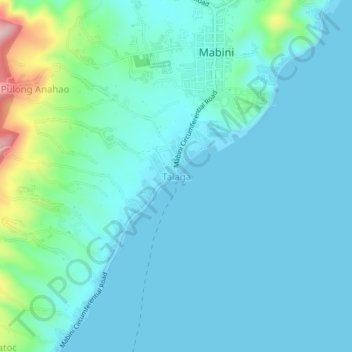
Name: Talaga topographic map, elevation, terrain.
Location: Talaga, Mabini, Batangas, Calabarzon, 4202, Philippines (13.71375 120.91610 13.75375 120.95610)
Average elevation: 37 m
Minimum elevation: 0 m
Maximum elevation: 244 m