
Kostroma Oblast topographic map
Interactive map
Click on the map to display elevation.
About this map
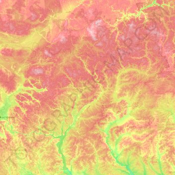
Name: Kostroma Oblast topographic map, elevation, terrain.
Location: Kostroma Oblast, Central Federal District, Russia (57.27217 40.39010 59.62360 47.63951)
Average elevation: 145 m
Minimum elevation: 64 m
Maximum elevation: 295 m
Other topographic maps
Click on a map to view its topography, its elevation and its terrain.
Gorky Reservoir
Russia > Kostroma Oblast > Козлово
Gorky Reservoir, 34К-143, Козлово, Makaryevsky District, Kostroma Oblast, Central Federal District, Russia
Average elevation: 99 m