
Badulla topographic map
Interactive map
Click on the map to display elevation.
About this map
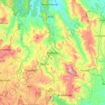
Name: Badulla topographic map, elevation, terrain.
Location: Badulla, Badulla District, Uva Province, 90000, Sri Lanka (6.83004 80.89703 7.15004 81.21703)
Average elevation: 855 m
Minimum elevation: 146 m
Maximum elevation: 2,016 m
Other topographic maps
Click on a map to view its topography, its elevation and its terrain.