
Lac Graham topographic map
Interactive map
Click on the map to display elevation.
About this map
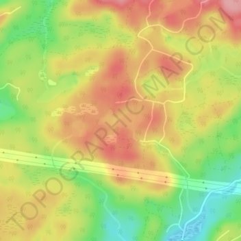
Name: Lac Graham topographic map, elevation, terrain.
Average elevation: 337 m
Minimum elevation: 266 m
Maximum elevation: 394 m
Other topographic maps
Click on a map to view its topography, its elevation and its terrain.
Lac Barrat
Lac Barrat, Rue Anne Est, Wentworth, Argenteuil, Laurentides, Québec, J83W8, Canada
Average elevation: 334 m
Baie Newton
Baie Newton, Chemin Acres, Wentworth, Argenteuil, Laurentides, Québec, Canada
Average elevation: 288 m