
Deurne topographic map
Interactive map
Click on the map to display elevation.
About this map
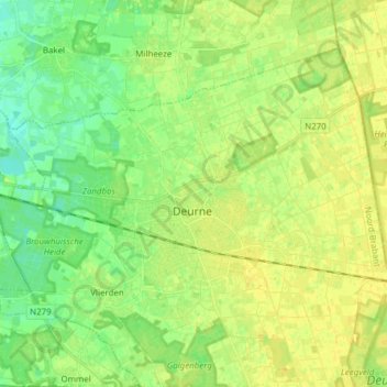
Name: Deurne topographic map, elevation, terrain.
Location: Deurne, Noord-Brabant, Nederland (51.43236 5.72172 51.50414 5.87501)
Average elevation: 27 m
Minimum elevation: 16 m
Maximum elevation: 35 m
Other topographic maps
Click on a map to view its topography, its elevation and its terrain.
Kanaal van Deurne
Nederland > Noord-Brabant > Deurne
Kanaal van Deurne, Deurne, Noord-Brabant, Nederland, 5757RS, Nederland
Average elevation: 31 m