
Thank you for supporting this site ❤️
Make a donation
Make a donation
Peravoor topographic map
Click on the map to display elevation.
Thank you for supporting this site ❤️
Make a donation
Make a donation
About this map
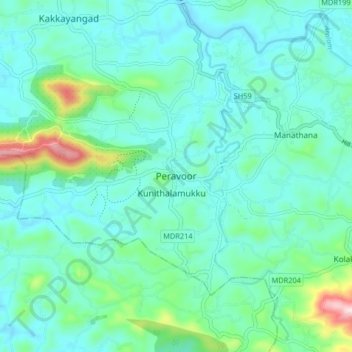
Name: Peravoor topographic map, elevation, terrain.
Location: Peravoor, Iritty, Kannur, Kerala, 670673, India (11.86135 75.69144 11.94135 75.77144)
Average elevation: 106 m
Minimum elevation: 41 m
Maximum elevation: 404 m
Thank you for supporting this site ❤️
Make a donation
Make a donation
Other topographic maps
Click on a map to view its topography, its elevation and its terrain.