
Burakhat topographic map
Interactive map
Click on the map to display elevation.
About this map
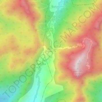
Name: Burakhat topographic map, elevation, terrain.
Location: Burakhat, Ramagiri, Gajapati, Odisha, India (18.95114 84.33367 18.99114 84.37367)
Average elevation: 1,049 m
Minimum elevation: 595 m
Maximum elevation: 1,494 m