
Chadayamangalam topographic map
Interactive map
Click on the map to display elevation.
About this map
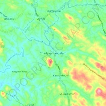
Name: Chadayamangalam topographic map, elevation, terrain.
Location: Chadayamangalam, Kottarakkara, Kollam, Kerala, 691534, India (8.83191 76.82912 8.91191 76.90912)
Average elevation: 70 m
Minimum elevation: 20 m
Maximum elevation: 191 m
Other topographic maps
Click on a map to view its topography, its elevation and its terrain.