
Patwa Dangar topographic map
Interactive map
Click on the map to display elevation.
About this map
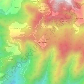
Name: Patwa Dangar topographic map, elevation, terrain.
Location: Patwa Dangar, Maneri, Nainital, Uttarakhand, 236002, India (29.31698 79.42707 29.35698 79.46707)
Average elevation: 1,321 m
Minimum elevation: 755 m
Maximum elevation: 1,839 m