
Malegaon topographic map
Interactive map
Click on the map to display elevation.
About this map
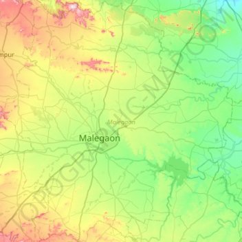
Name: Malegaon topographic map, elevation, terrain.
Location: Malegaon, Nashik, Maharashtra, India (20.34533 74.31257 20.83591 74.81277)
Average elevation: 463 m
Minimum elevation: 295 m
Maximum elevation: 875 m
Other topographic maps
Click on a map to view its topography, its elevation and its terrain.
Malegaon
India > Maharashtra > Malegaon
Malegaon, Nashik District, Maharashtra, 423200, India
Average elevation: 463 m