
Rann of Kutch topographic map
Interactive map
Click on the map to display elevation.
About this map
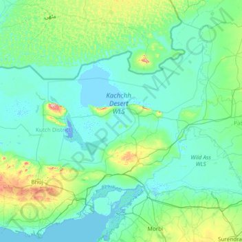
Name: Rann of Kutch topographic map, elevation, terrain.
Location: Rann of Kutch, Kachchh, Gujarat, India (23.09523 69.00764 24.48586 71.39424)
Average elevation: 31 m
Minimum elevation: -5 m
Maximum elevation: 432 m
Other topographic maps
Click on a map to view its topography, its elevation and its terrain.
Ravapar Navavas
India > Kachchh > Ravapar Navavas
Ravapar Navavas, Nakhatrana Taluka, Kachchh, Gujarat, 370625, India
Average elevation: 93 m